Oil & Gas Atlas of Libya on ArcGIS Online
The descriptions in our online atlas of the oil and gas fields of Libya, the maps, cross-sections and reserves estimates, are more comprehensive, transparent and authoritative than any others previously available to the industry and represent an essential aid to any company actively interested in Libya. The state of the art format allows for easy access even on a smartphone or tablet.
License holders are able to:
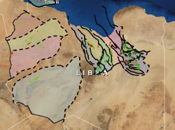
- Zoom and navigate over the entire map of Libya
- Search for data on specific fields and wells
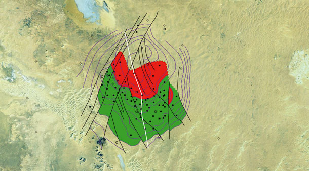
- Review top reservoir depth maps by field
- Discover oil and gas reserves estimates by field
- Identify trapping mechanisms
- See the specific data (porosity, Sw etc) behind the reserves estimates
- Select geological cross sections across any field or region and read about the key petroleum systems (the plumbing)
 The 'ESRI ArcGIS Online' platform is a 'Cloud' based Geographical Information System (GIS) that is used to deliver the Nubian Consulting ‘Oil and Gas Atlas of Libya’ to clients through the internet. ESRI is the world leader in the area of Geographical Information Systems and provides the benchmark product in the oil industry. The service allows viewing and accessing of geospatial data via the ArcGIS Online webpage, where no additional servers or infrastructure are required.